Search Returned...
|
|
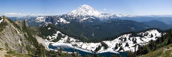
Mount Rainier From Tolmie Station
Tuesday, June 9th, 2009 at 08:24:06 Even though we were standing on a mountain top (or very close to it - the actual peak (a few feet higher is on the ridge on the extreme left of the frame), Rainier is still thousands of feet above us. That is Eunice lake below and you can just see Mowich lake in the valley beyond. John Harvey Photo > Trips out of the Country > Seattle Rainier > Mount Rainier From Tolmie Station
|
|
|
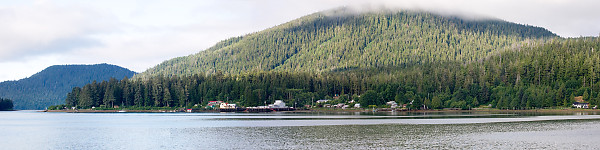
Winter Harbour Panorama
Tuesday, June 9th, 2009 at 08:13:17 This is three shots and Hugin. This is a 4:1 ratio pano (I prefer 3:1) but I didn't take enough vertical. John Harvey Photo > John's Overnight Page > Winter Harbour To Brooks Peninsula > Winter Harbour Panorama
|
|
|
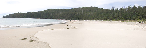
Wide Sandy Beach
Tuesday, June 9th, 2009 at 08:13:16 Wide Sandy Beach John Harvey Photo > John's Overnight Page > Winter Harbour To Brooks Peninsula > Wide Sandy Beach
|
|
|
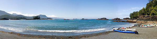
Brooks Beach Pano
Tuesday, June 9th, 2009 at 08:13:06 Brooks Beach Pano John Harvey Photo > John's Overnight Page > Winter Harbour To Brooks Peninsula > Brooks Beach Pano
|
|
|
Night North
Tuesday, June 9th, 2009 at 08:02:21 And had good timing. John Harvey Photo > House > Night North
|
|
|
Day North
Tuesday, June 9th, 2009 at 08:02:20 They must have used a pretty nice camera on that weather balloon. John Harvey Photo > House > Day North
|
|
|
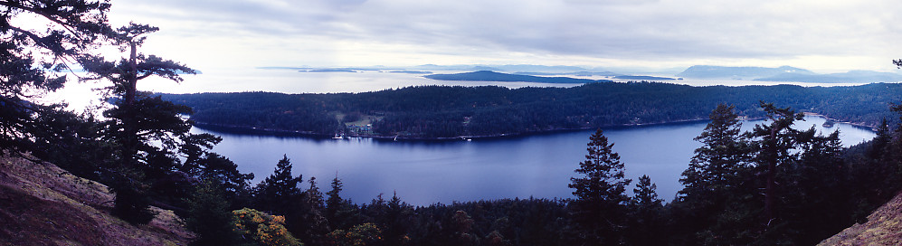
Mt Norman View
Tuesday, June 9th, 2009 at 07:59:29 This is my first High Dynamic Range Pano - using a few tricks I've learned for panotools. I was here once before. John Harvey Photo > Kayaking in the Gulf Islands > Mt Norman View
|
|
|
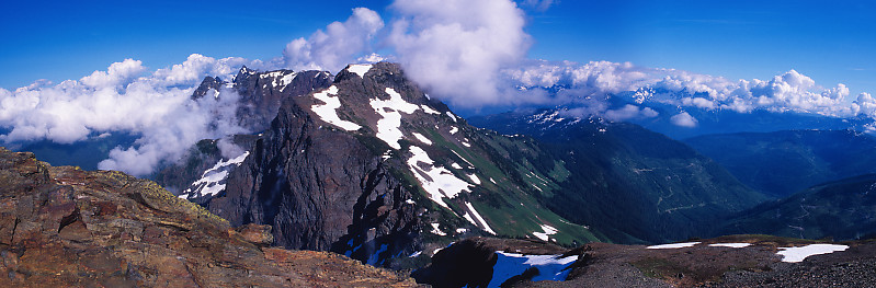
Lady Peak From Summit
Tuesday, June 9th, 2009 at 07:58:18 I believe it's Lady Peak, but I'm not 100% John Harvey Photo > John Harvey Photo - Hiking > A Second Attempt on Mt Cheam > Lady Peak From Summit
|
|
|
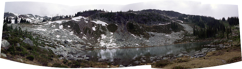
Harmony Lake
Tuesday, June 9th, 2009 at 07:57:58 4 images. The flat light really doesn't do much here. John Harvey Photo > John Harvey Photo - Hiking > Whistler Peak and Harmony Lake > Harmony Lake
|
|
|
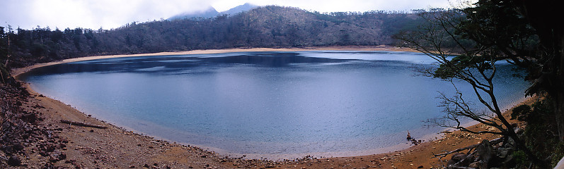
Crater Lake
Tuesday, June 9th, 2009 at 07:56:25 This is a three frame image. John Harvey Photo > Trips out of the Country > A Third Trip to Japan > Ebino Kohen > Crater Lake
|
|
|
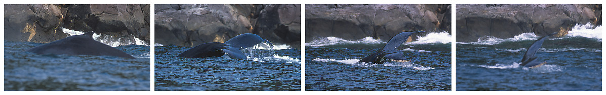
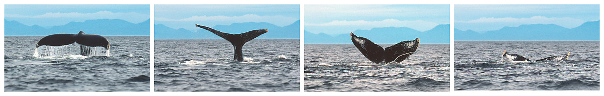
Dive Sequence By Rocks
Tuesday, June 9th, 2009 at 07:52:09 Here three whales were feeding quite close to a rock wall - the water is about 130 feet deep here. This Humpback (Megaptera novaeangliae) has most of one fluke missing. Species: Megaptera novaeangliae (Humpback Whale)
John Harvey Photo > Aristazabal Island > Aristazabal Island - Day 5, 6 > Dive Sequence By Rocks
|
|
|
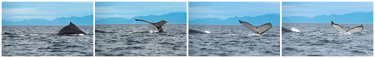
Dive Sequence
Tuesday, June 9th, 2009 at 07:52:08 At this location, the whales would come up to the surface and breath about 5 to 8 times and then dive again, generally for 6 to 8 minuets. You can tell there last breath at the surface because you would see the hump back, and then the tail as they go down. Species: Megaptera novaeangliae (Humpback Whale)
John Harvey Photo > Aristazabal Island > Aristazabal Island - Day 5, 6 > Dive Sequence
|
|
|
Dive Sequence
Tuesday, June 9th, 2009 at 07:52:08 I love all the water that runs off the flukes as the tail comes out of the water. Species: Megaptera novaeangliae (Humpback Whale)
John Harvey Photo > Aristazabal Island > Aristazabal Island - Day 5, 6 > Dive Sequence
|
|
|
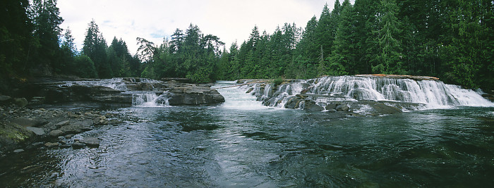
Stotan Falls
Tuesday, June 9th, 2009 at 07:51:16 These falls are just below the confluence of the Puntledge and Browns Rivers. A fish ladder has been carved into the center of the falls. John Harvey Photo > A Weekend in Comox > Stotan Falls
|
|
|
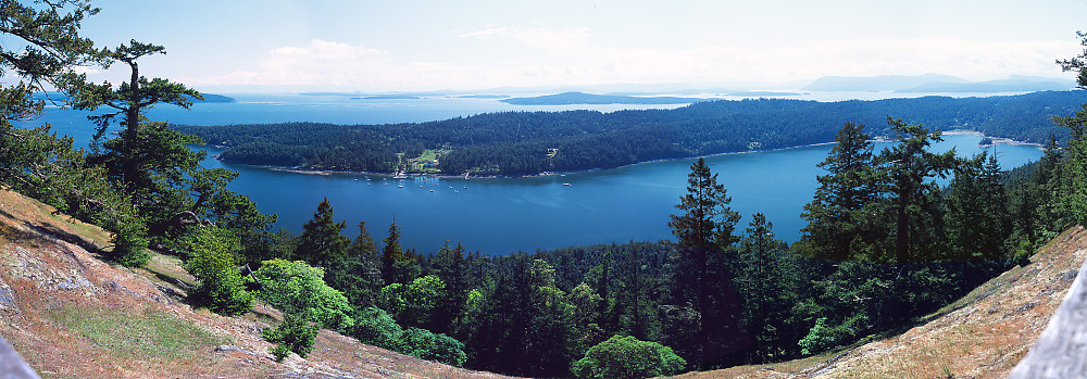
View From Mount Norman
Tuesday, June 9th, 2009 at 07:49:54 This is a 7 shot panorama. To get a sense of distortion (this is getting close to 180 degrees), that brown/grey bits in the corners is a wooden guard rail. In real life, it's straight. I've been here again since. John Harvey Photo > Pender Island for the May Long Weekend > View From Mount Norman
|
|
|
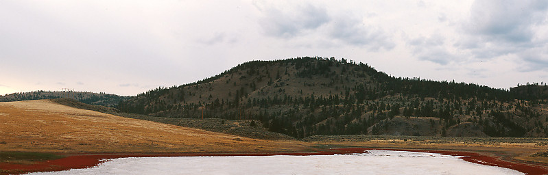
Salt Lake Panorama
Tuesday, June 9th, 2009 at 07:48:25 This is just west of Kamloops. I love the bright red plants growing around the lake - I would have liked to go down and take a closer look, but there was a fence between here and there. John Harvey Photo > A BC Road Trip > Jasper To Lillooet > Salt Lake Panorama
|
|
|
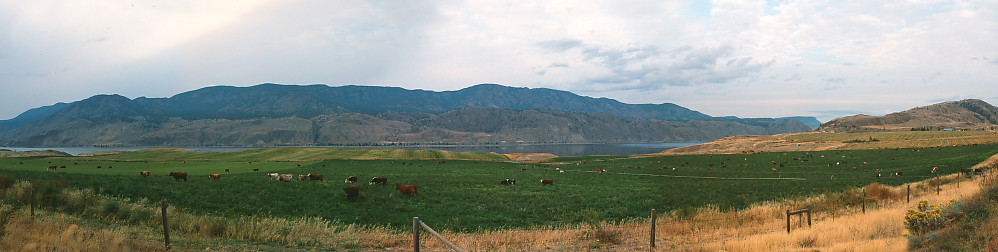
Lake Kamloops Panorama
Tuesday, June 9th, 2009 at 07:48:24 The irrigated pasture is quite different from the surround brown grass. John Harvey Photo > A BC Road Trip > Jasper To Lillooet > Lake Kamloops Panorama
|
|
|
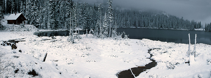
Lake Side View
Tuesday, June 9th, 2009 at 07:47:20 Lake Side View John Harvey Photo > A BC Road Trip > Castlegar to Radium Hot Springs > Lake Side View
|
|
|
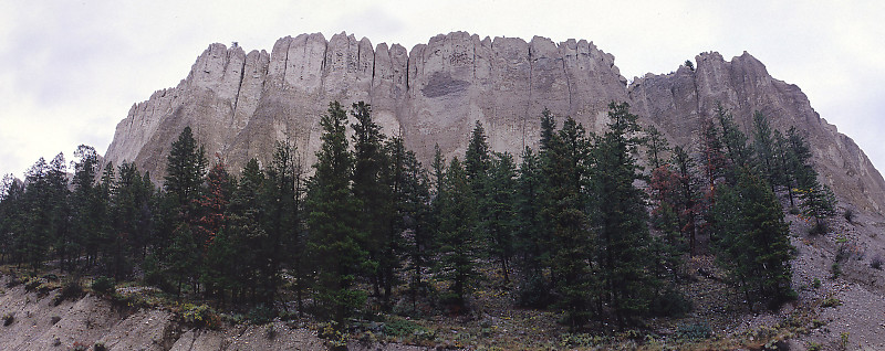
Dutch Creek Hoodoos
Tuesday, June 9th, 2009 at 07:47:18 I'm pretty sure these are the Dutch Creek Hoodoos, but I'm not 100%. Tags: panorama
John Harvey Photo > A BC Road Trip > Castlegar to Radium Hot Springs > Dutch Creek Hoodoos
|
|
|
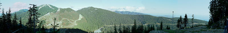
Panoramic
Tuesday, June 9th, 2009 at 07:40:13 This is a 5 shot seamed together image. Tags: vista
John Harvey Photo > John Harvey Photo - Hiking > Howe Sound Crest Trail & Black Mountain > Panoramic
|